New Bridgewater Bridge Urban Design & Visual Impact Assessment
Hobart's new northern gateway
Project Overview
Project type: Master Plan, Urban Design
Client: Tasmanian State Government
A $750-million new bridge was proposed to replace a historic convict-built causeway to become the northern gateway to/from Hobart, Tasmania. I created visually accurate photo-montages to assess impact to landscape character and developed urban design interventions.
My Role
One of two consultant landscape architects that developed the urban design master plan.
I led the visual impact assessment of the project by developing visually accurate montages to depict the infrastructural impact on the heritage landscape.
The Project
The Tasmanian Department of Infrastructure, Energy and Resources wanted to integrate a major new bridge into the suburban community at the northern gateway into Hobart. They needed to apply for federal funding and needed to show that the project would benefit the community and respond to strong heritage values and community revitalisation, as the new bridge would be replacing a significantly historic convict-built causeway.
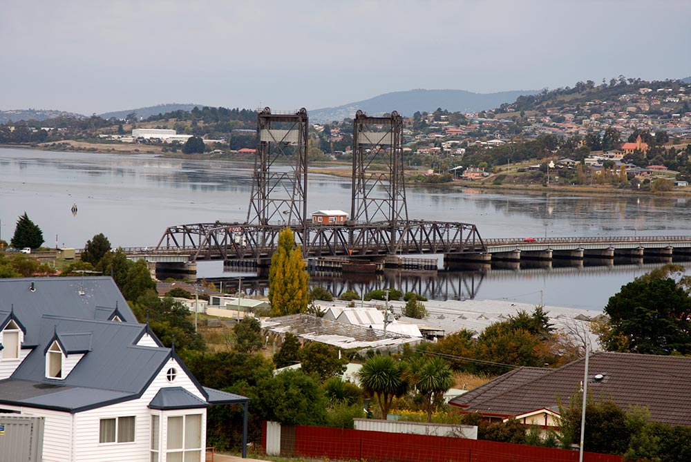
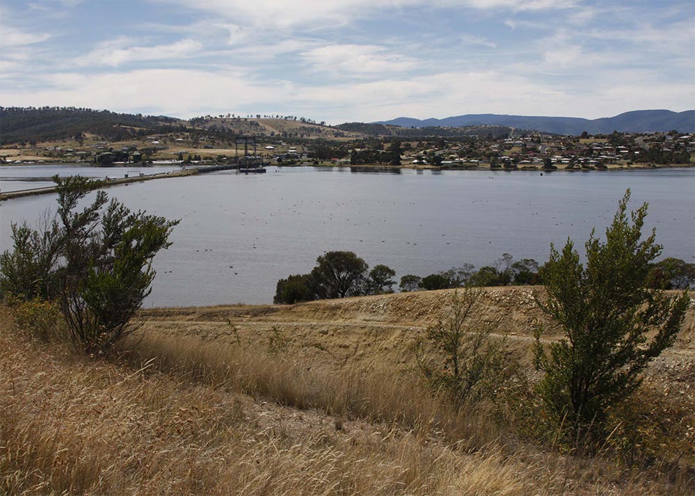
The heritage landscape and convict-built causeway
Visual Impact Assessment
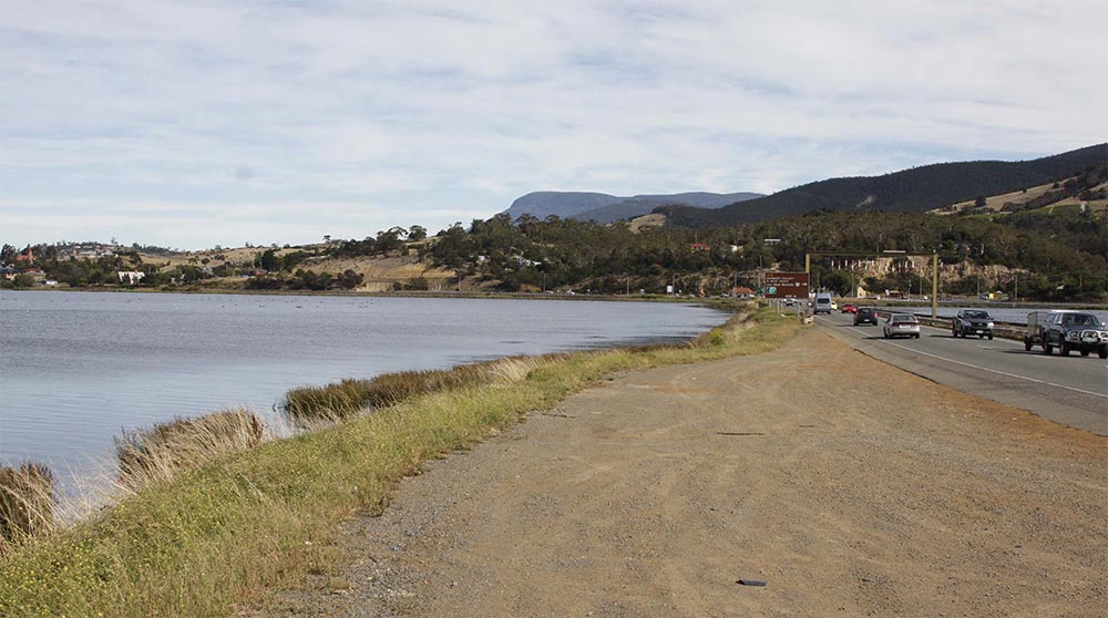
In order for the state government to receive funding from the federal government, the engineered solution had to consider the impact on the heritage landscape. It was also required that a community management component be part of the project.
This was achieved through a visual impact assessment that utilised visually-accurate montages of the proposed bridge. I was for responsible for creating the montages to use in the evaluation process.
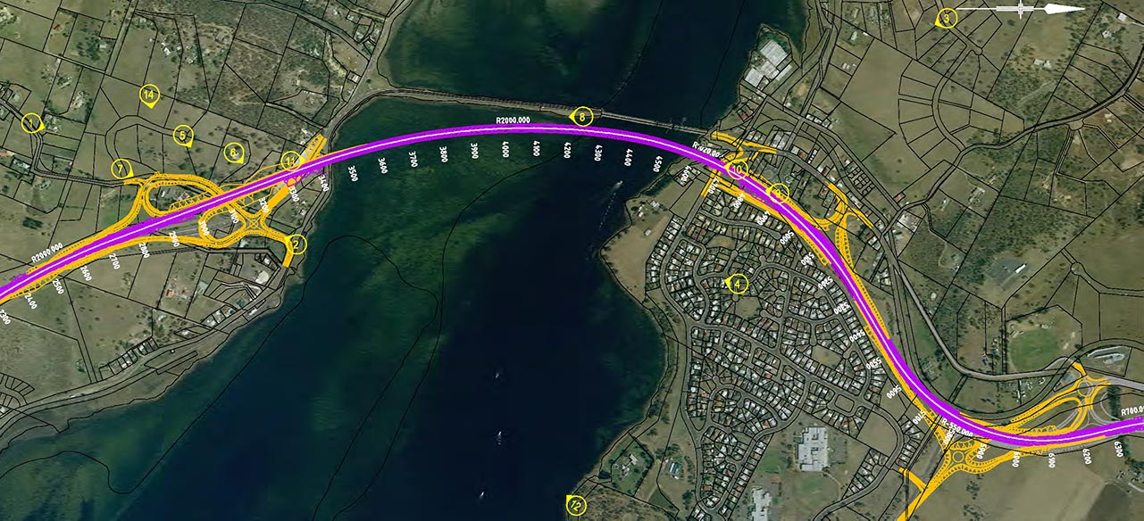
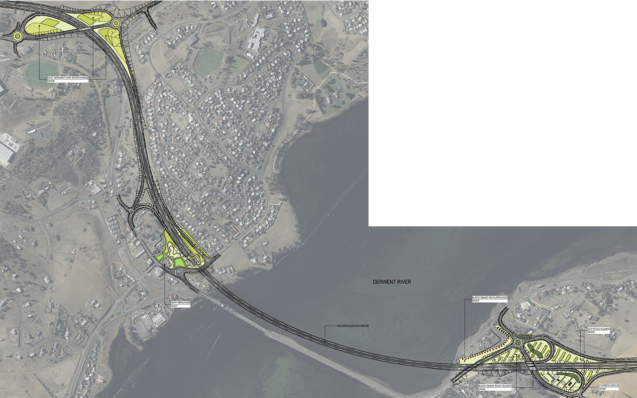
The plan below shows the location of the proposed bridge and where photomontage locations were established.
I developed a process integrating GIS location, surveying techniques, photographic EXIF data, and CAD 3D modelling tools to create highly accurate images that would depict the future built environment.
I liaised with a government official and engineers to finalise the montages which were then used to evaluate the impact to the heritage landscape. The images were also used to consult with community groups and attract Federal Government support.
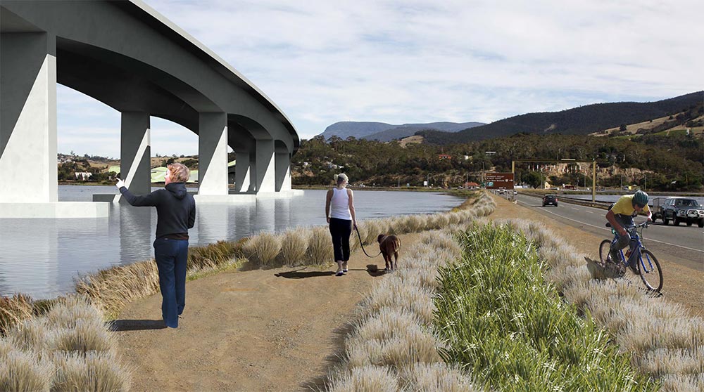
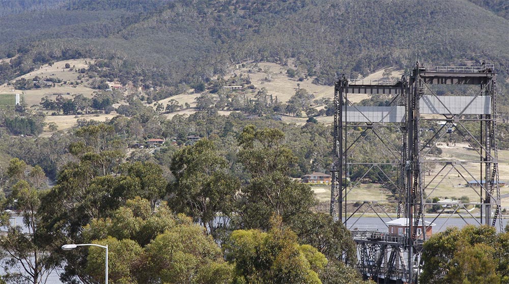
Causeway visualisation
This montage depicts a possible view from the old heritage-listed causeway that would run alongside the new proposed bridge. The montage also depicts a linear park along the old causeway which is part of my urban design intervention.
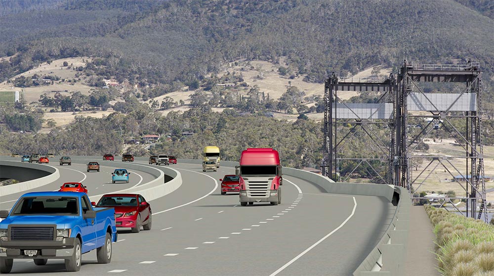
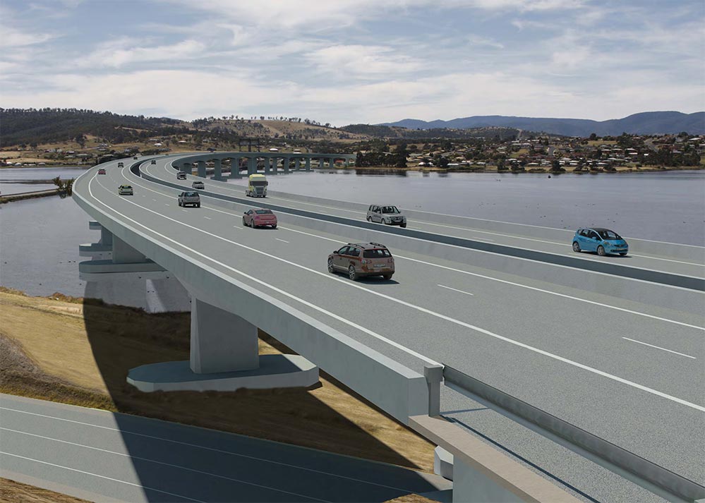
New roadway level
This montage depicts an accurate view from the proposed bridge roadway level, looking towards Hobart.The view depicts what the new entrance way to Hobart would look like.
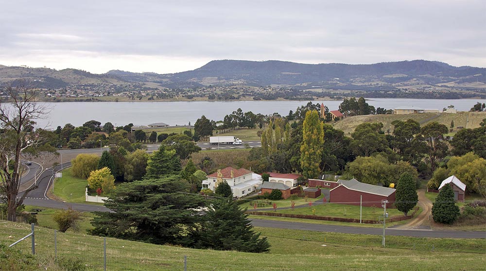
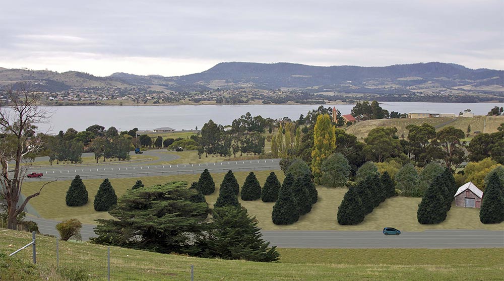
Historic roadway change
This montage displays a view from an historic road entering into the proposed interchange for the future bridge. The landscape in this image is a visualisation of a planting concept my colleague and I developed that referenced the historic surroundings and mitigated the visual impact of the infrastructure.
Northern view
This montage depicts an accurate view from the proposed bridge roadway level, looking North away from Hobart and towards the old convict-built causeway.
Local news
Two of my montages were published in Hobart’s Mercury newspaper on page 7, on January 11, 2012.
Urban Design and Landscape Master Plan
In addition to the visually-accurate montages, we had to create an urban design and landscape master plan that responded to strong heritage values and created sustainable transport for the local community. The landscape component responded to the prominent rural and historic landscape character. The urban design responded to the community’s need for suburban revitalisation.
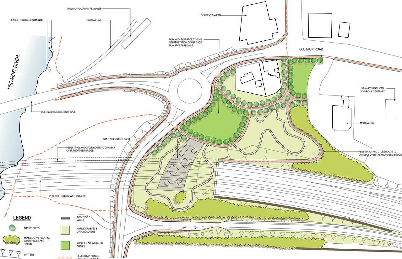
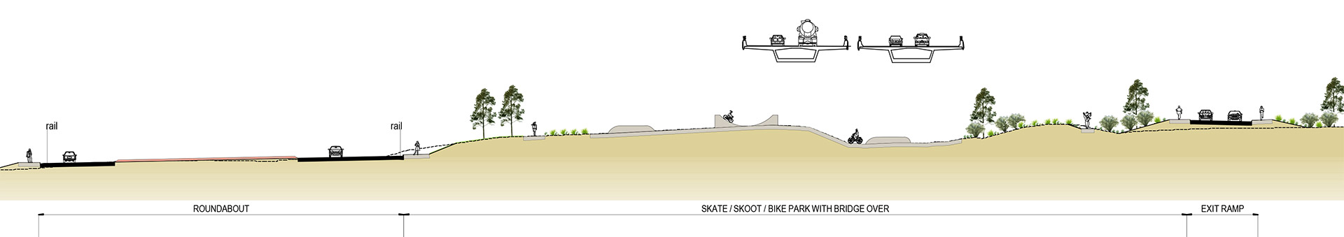
Eastern Shore Urban Design
This detail plan shows an urban design concept I developed for the northern end of the proposed new bridge that bisects an existing suburb. At the time, the village in this location felt it had no ‘centre’ to gather.
I proposed the space to be reactivated with a skate and bike park, which integrated walking and bicycling trails that would link the village with the river foreshore. A transport-themed public park incorporated some historic sites and was fringed by the local pub, a small museum and restaurants.